One of the many natural highlights Ecuador has to offer is a visit to the Cuicocha. Located in the northern province of Imbabura.
Visit Cuicocha: Background info
The Cuicocha crater lake is located near the famous Andean market town of Otavalo (30 min. in taxi). Nearer even to the Magical City of Cotacachi (15 min.).
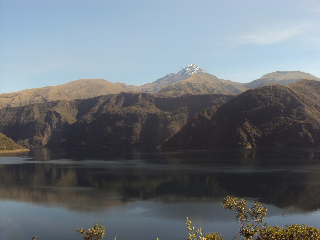
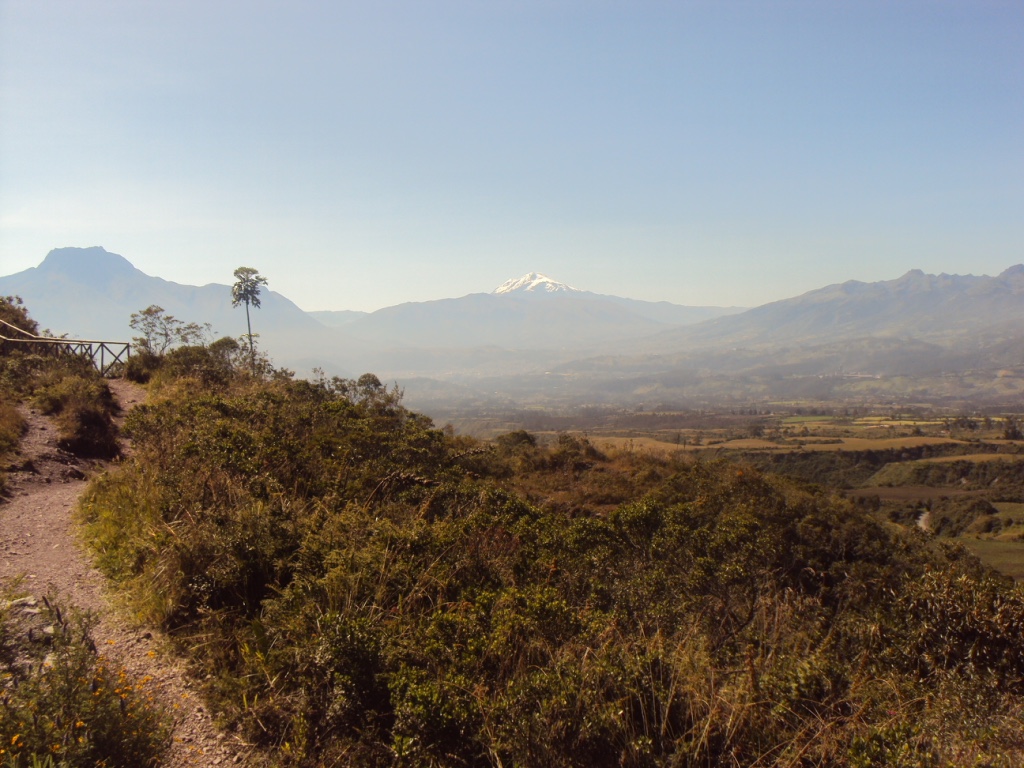
The lake lies way below the summit of Mt. Cotacachi (4944m/ 16220ft). The 10th highest volcano of Ecuador.
- In its current form, Lake Cuicocha was only shaped recently. That’s just over 3000 years ago!
Where does the name Cuicocha come from?
“Cuicocha” means the Lago del Cuy, the Lake of the Guinea Pig.
- Cui or Cuy is Quichua for Guinea Pig, which the indigenous people consider a delicacy. Cocha = Lake.
The name is supposedly derived from the larger of the lake’s central islands, which – with a little imagination – resembles the back of a guinea pig.
Some sources state Cuicocha actually means the Lago del Arco Iris, the Lake of the Rainbow. While others think it stands for the Lago de Dioses, the Lake of the Gods.
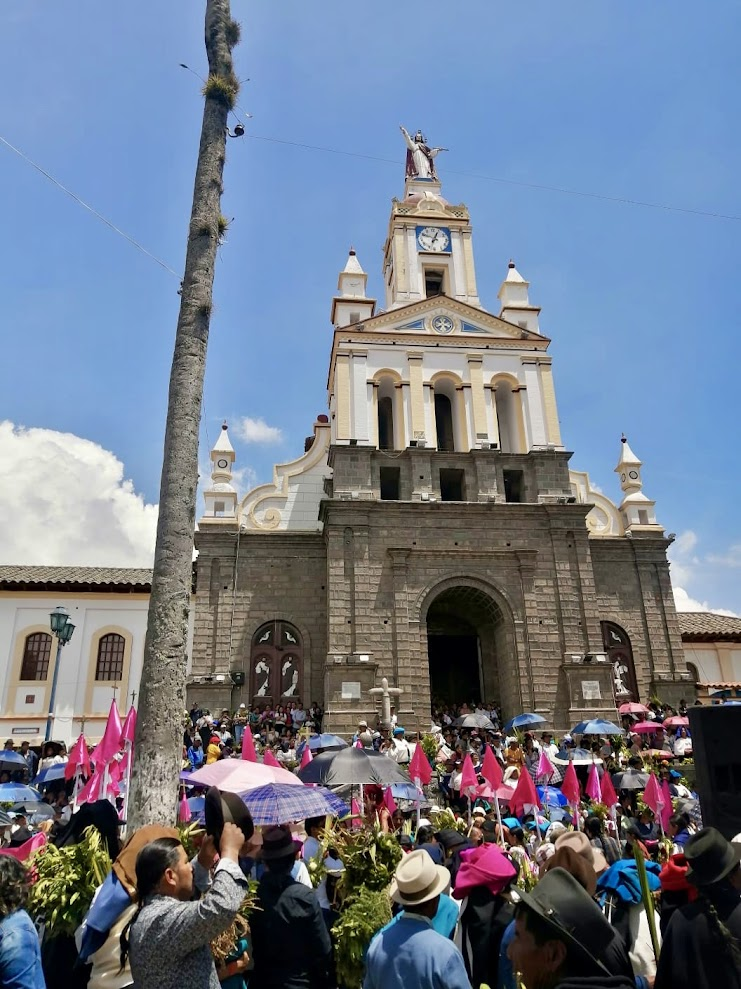
Whatever the case, the indigenous people continue to visit & honor the lake regularly. Periodically they organizing rituals such as bringing offerings & taking ritual baths.
Two islands, not one
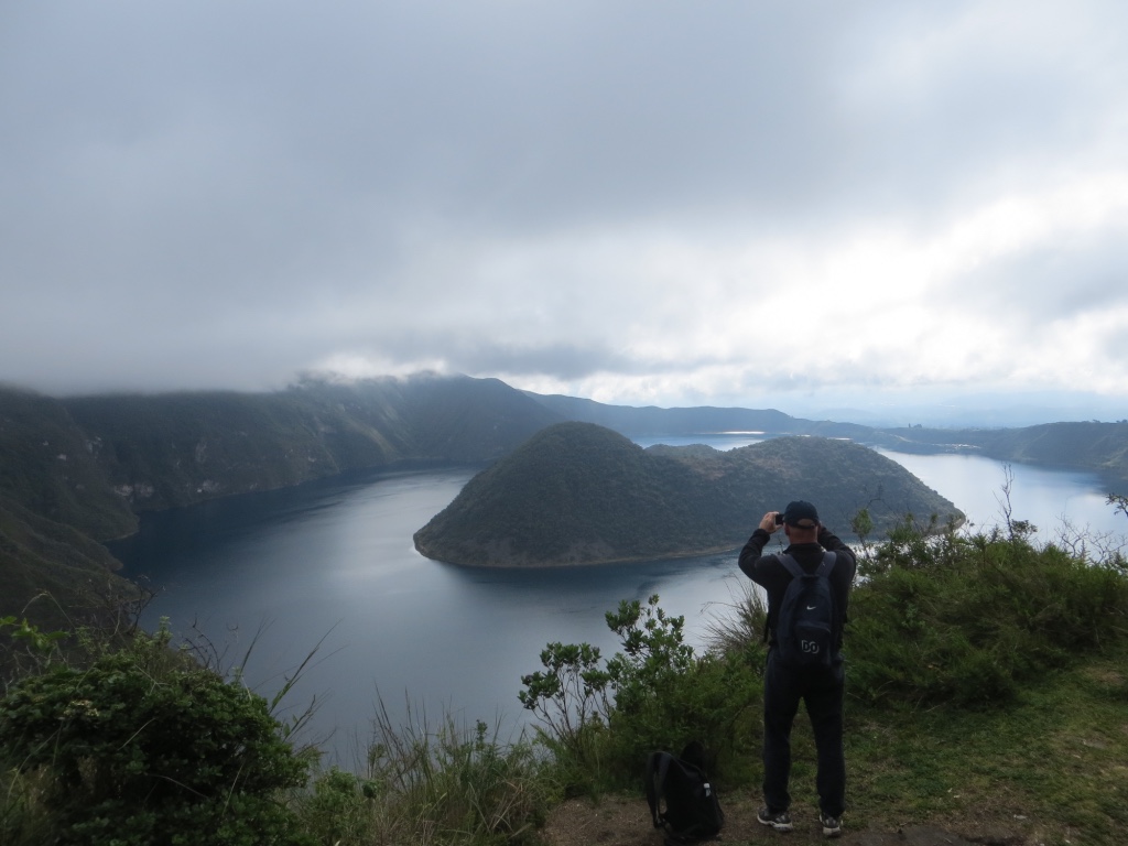
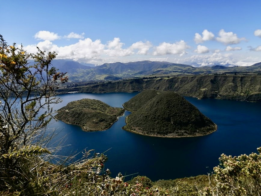
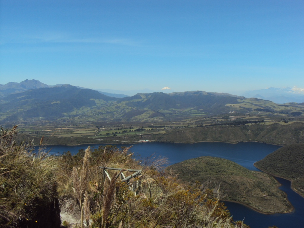
Characteristically are the two islands in the middle of the lake.
From certain angles it may look like there’s only one island, but there are actually two.
The bigger one is named after a German scientist, the geologist & botanist Teodoro Wolf (1841-1924).
- Wolf realized important scientific work all over Ecuador. That’s why, besides this small island, one of the Galápagos Islands is also named after him. As well as a volcano.
The name of the smaller island is Yerovi. Named after the Ecuadorian priest & later bishop José María de Jesús Yerovi (1819-1867).
As a young man, Yerovi visited Cuicocha with some friends, but almost lost his life after their boat capsized. The small island was their last refuge & because of that was named after him.
Both islands were formed after the last eruption. They behave like two corks or a split cork, tapping the opening of the lake to the Earth’s center.
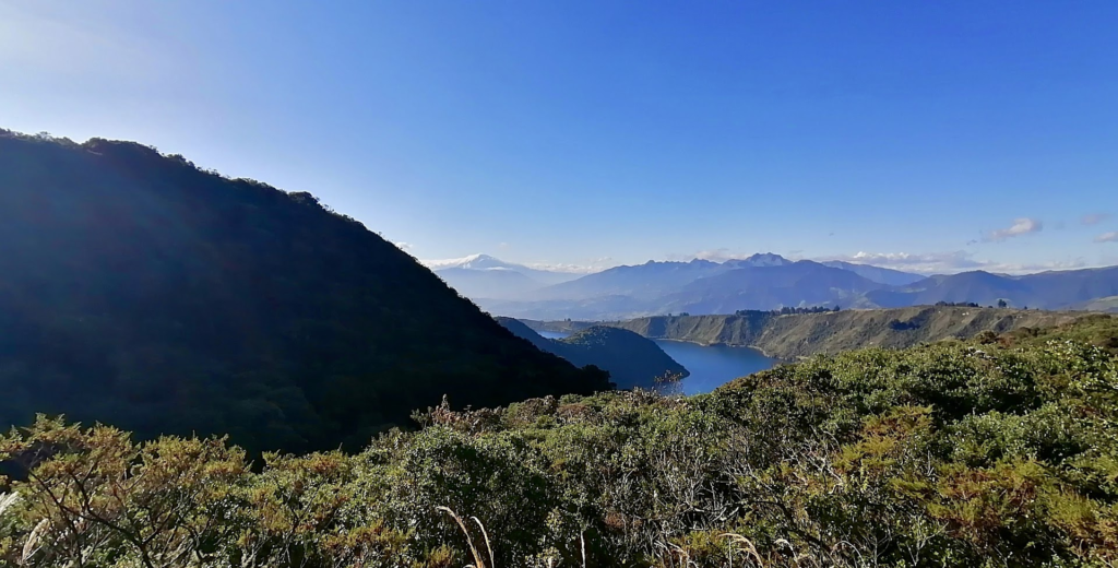
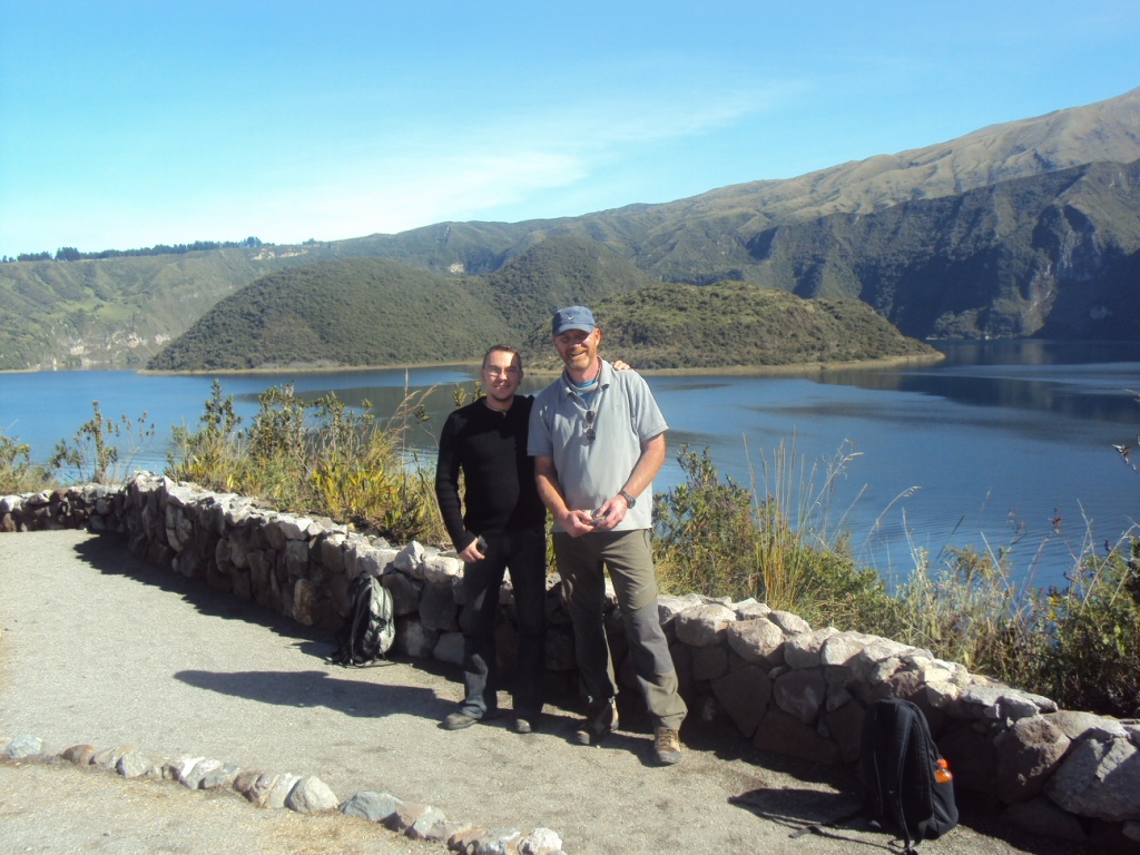
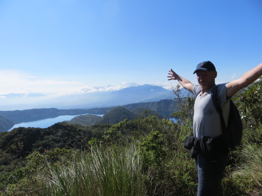
From the shore or from the lake, the islands provide us with magical views.
- I twice had the honor to see them from above. Once from an airplane, bringing me back to Ecuador. The second time, when I was standing on the nearby Fuya Fuya volcano on a clear day. A unique sight.
National park & Geopark
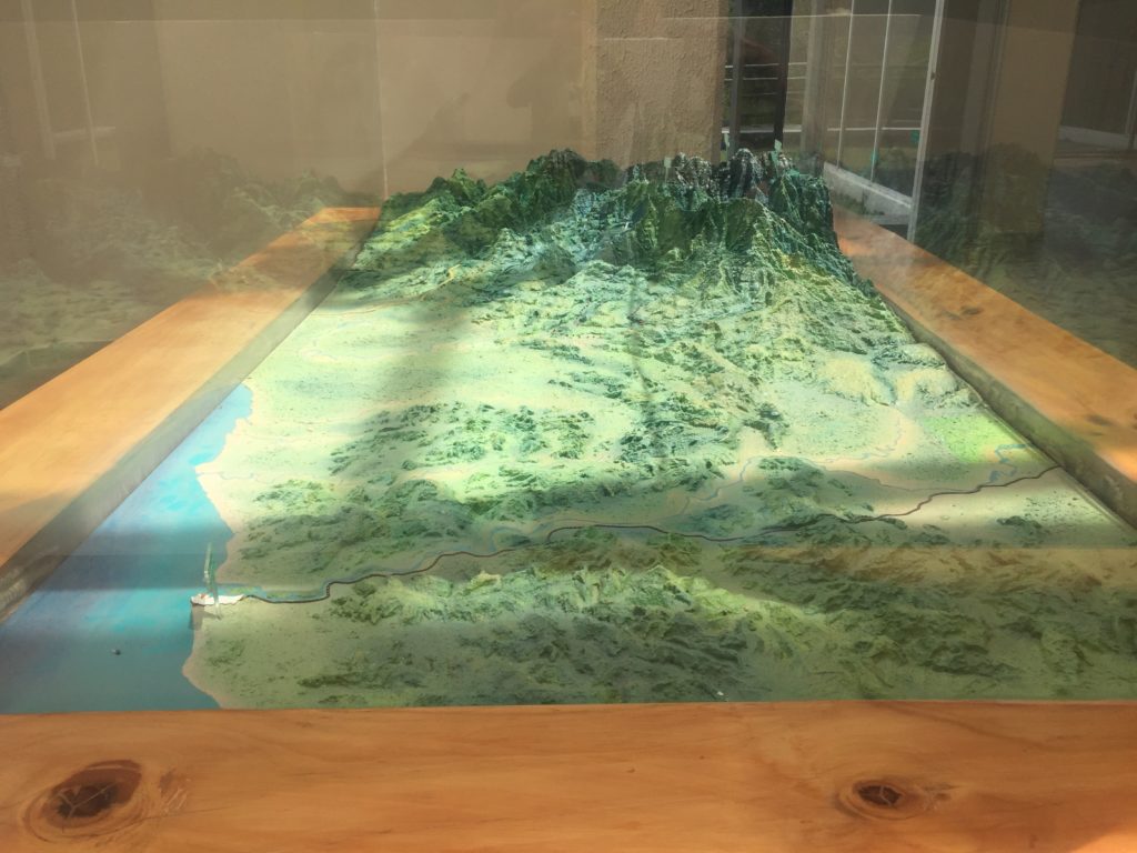
What many visitors don’t know is that Cuicocha is just a tiny part of one of the biggest national parks of Ecuador. The Cotacachi-Cayapas Ecological Reserve, inaugurated in 1968. An area of 243 638 hectares (about 941 square miles), which stretches all the way to the Ecuadorian coast.
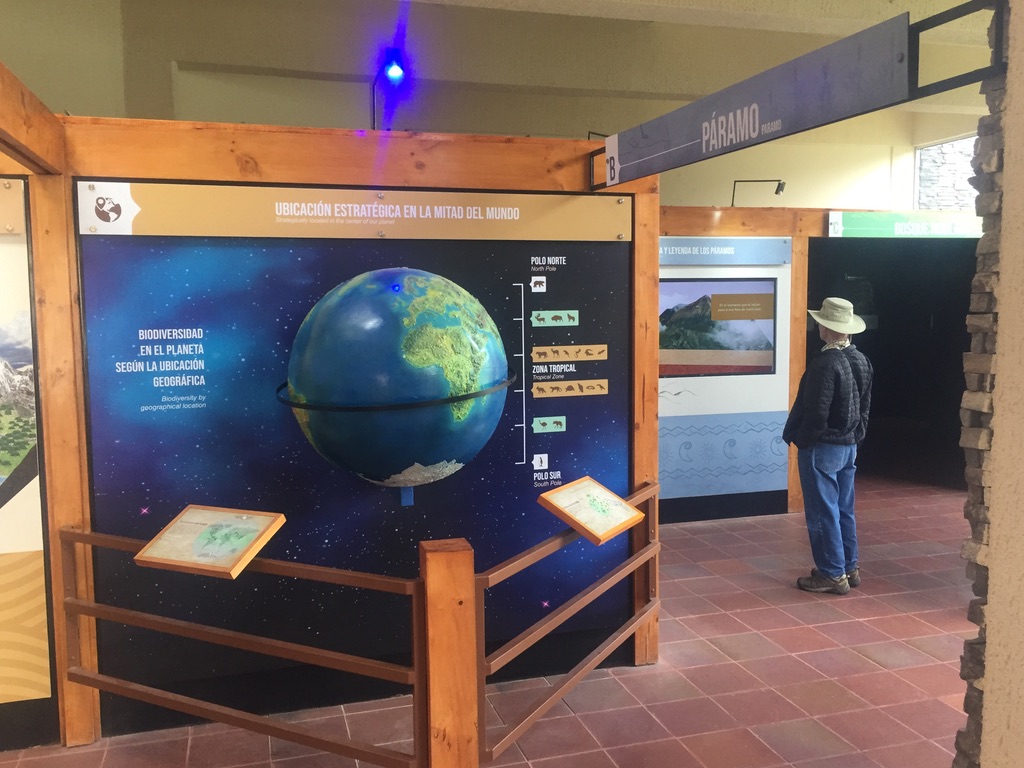
To get an idea of the whole area, there’s a beautiful scale model in the local museum at the lake.

Besides being a national park, the whole province of Imbabura recently was declared a Geopark by the Unesco. It deserved that distinction mainly because of its many Natural Attractions. Like, for example, 28 bigger lakes.
Besides Cuicocha, the best known lakes are San Pablo, Yahuarcocha, and the Mojanda lake area. The last area houses three bigger lakes, as well as the Fuya Fuya volcano.
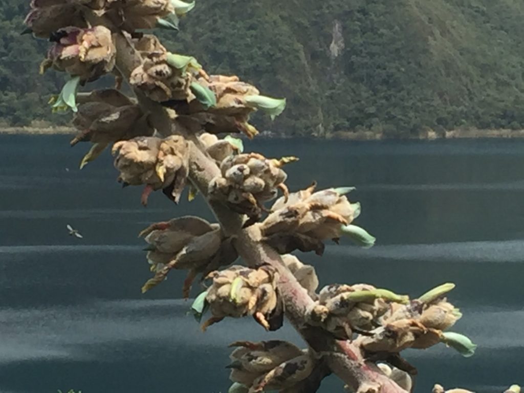
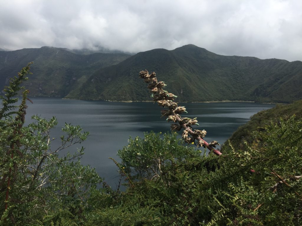
The unique Flora & Fauna of Cuicocha
When you visit the Cuicocha crater lake, you find yourself in a unique natural habitat – almost like visiting a small biosphere. That’s because you are inside a crater.
It’s as if you are walking on the outer rim of a deep plate… a deep plate of soup, if you will. With views all around – open to the south & east, blocked by Mt. Cotacachi and its flanks in the northern & western direction.
You can spot plants, flowers, birds (different kinds of hummingbirds), little animals, and insects that are unique to this particular lake. In other words, flowers, plants and animals you won’t see in other areas of the country, or even… nowhere else in the world!
And if you’re lucky …
Some people have even spotted the Oso Andino/ Andean bear on the northern side of the lake (the side of the Mt. Cotacachi).
- The Andean bear is also known as the Oso de Anteojos/The Spectacled Bear.
Honestly, you have to be lucky to see one, but it’s certainly true that the bears live in the area. And because of the fact that the government nowadays is trying to protect them, the chances are getting bigger & bigger to spot one or two. Here, during your visit to Cuicocha, or elsewhere.
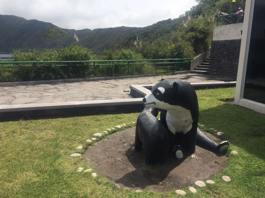
One of the places in Ecuador where you certainly can spot them is in Pimampiro. In the northern canton of the Imbabura province there’s a project protecting a group of bears living in one of their valleys. The project is called the Mirador del Oso Andino.
Until now I haven’t got the honor myself to spot a bear in the Cuicocha lake area. However, there are more & more people who told me of hearing or spotting one.
Visit Cuicocha: Go for a hike!
The starting point
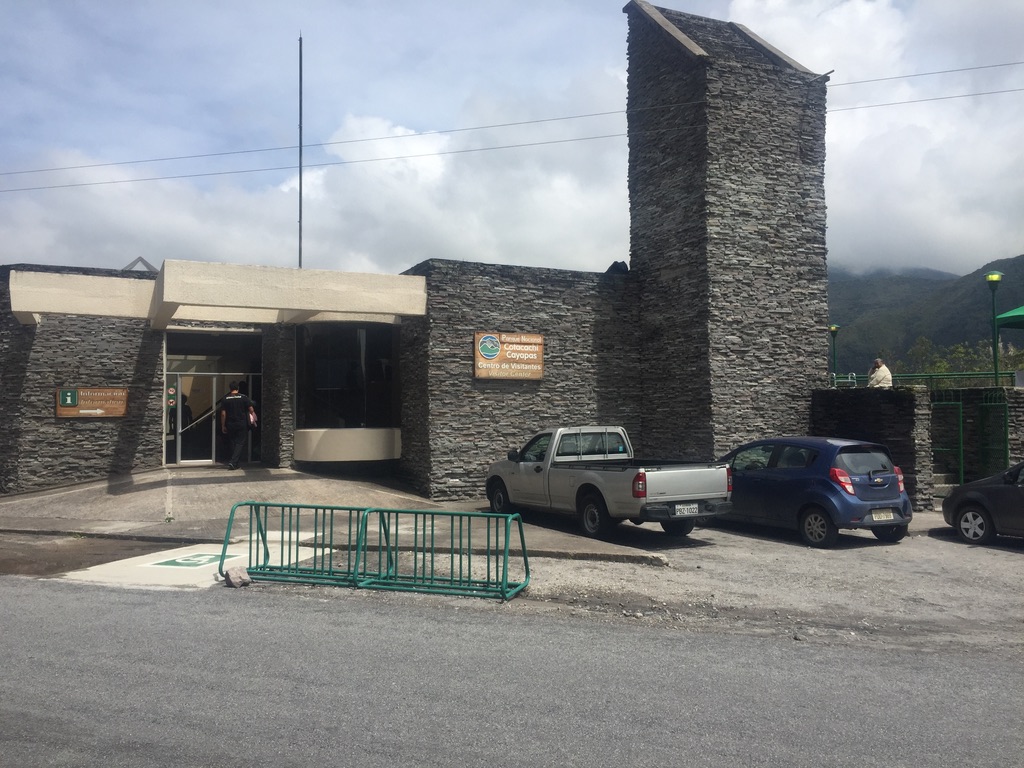
Cuicocha is one of the easiest lakes to visit, because a road leads right into the crater. Taxis and pickups can leave you right at the Centro de Vistantes/ Visitors center. The starting point for your hike around the lake.
You can make the whole round or choose a shorter route. In other words, it is NOT necessary to circle the whole lake to get a good impression of the area & its unique flora & fauna.
After getting through the main entrance you’ll find the Visitors center on your right hand side. As you probably will arrive in a taxi or a pickup, ask the driver to drop you off there.
Clockwise or counterclockwise?
A few years ago the authorities tried to force every visitor to round the lake counterclockwise. I don’t know why really…? Maybe somebody at one of the ministries suffered from an Ecuadorian style Himalaya-syndrome.
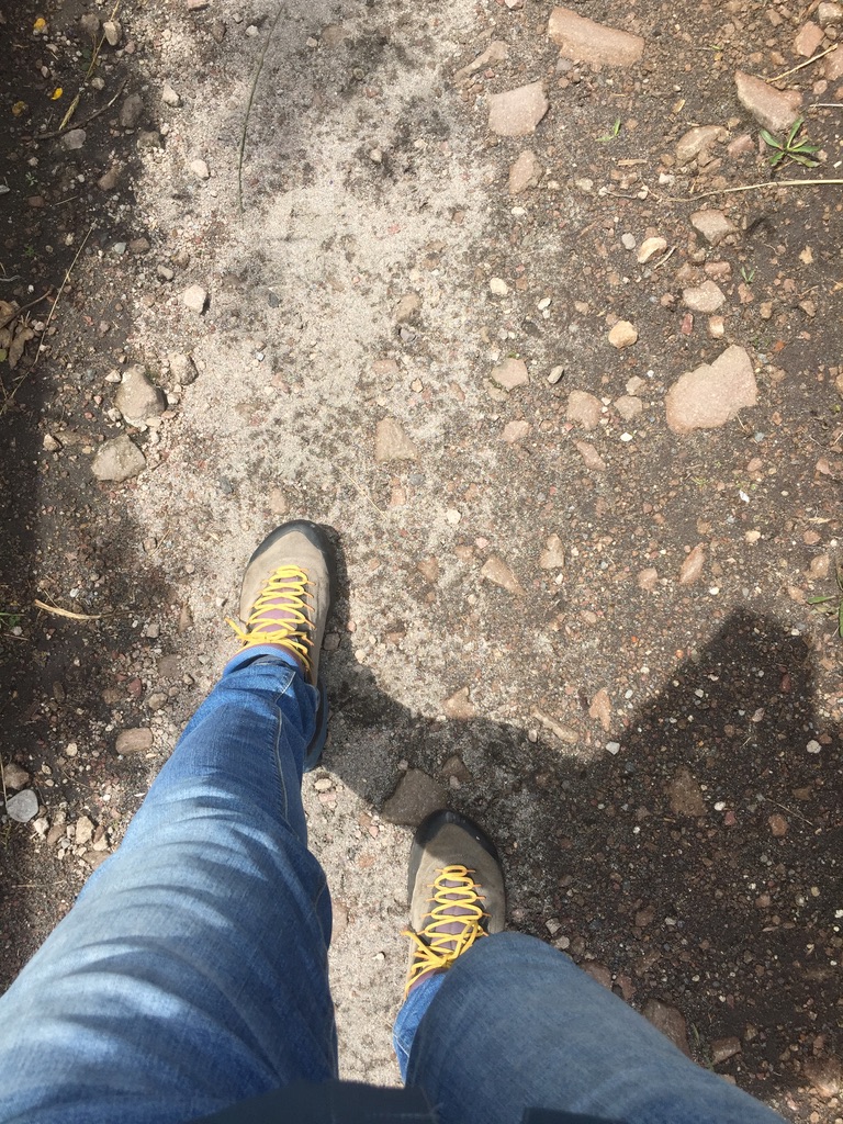
- Funny story! At the same time, it was prohibited to visit the lake on a bike. What a joke! I once got there myself on my bike, climbing up from about 2400m (7900 ft) to 3100m (10200 ft). More dead than alive, purple instead of just a deep sweaty red. And then, BIG SURPRISE .. They stopped me at the gate! At least that was what the Park ranger thought he was doing… I passed him without a word, had a short break at the lake, before my “flight” back home. Not after protesting at the entrance about the stupid rule of letting car & bus drivers in, while bikers weren’t!). Since, rules have changed!
Concerning the clock, rules have also changed. So you can make the round counterclockwise or clockwise. Whatever you wish! You can do this, despite the fact that there still remain some signs – or maybe even some blogs or guidebooks – indicating otherwise.
Both routes are OK. There isn’t much difference between the two, I think. Maybe the counterclockwise route is just a little bit harder in the beginning, when the legs need to get warm & you have to find your rhythm.
Make the Long tour around Cuicocha
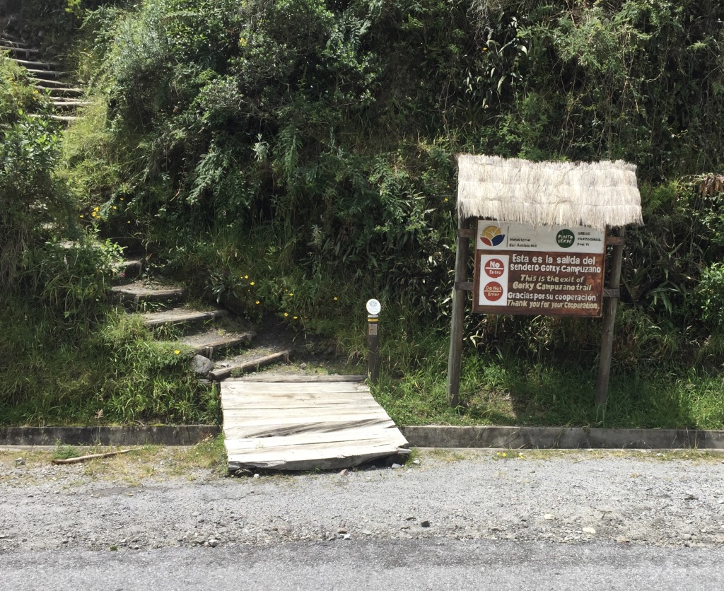
Head to the right side of the Visitors center & take the stairs. Or, if you like, cross over to the other side and start at the “Exit” sign (see photo above).
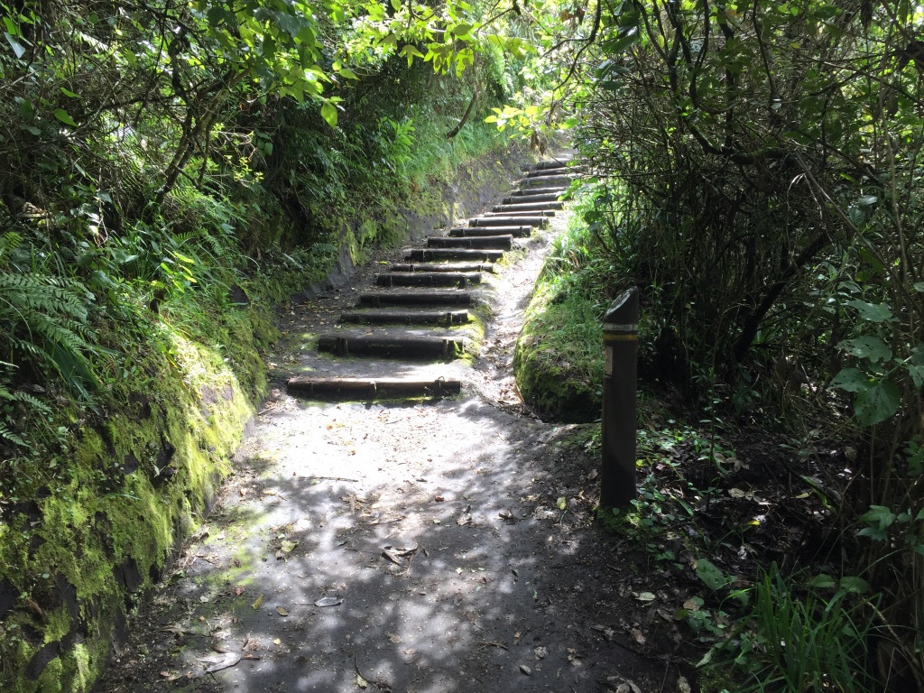
The whole path around the lake is 14km/ 8.5 miles long. This route or path/sendero is called Las Orquídeas/ The Orchids and takes you around the lake in about 4 to 5 hours.
When it comes to altitude, you’ll go up & down between 3100m and 3500m (10000ft -11500 ft).
The path follows the crater rim almost permanently, giving you spectacular views of the lake & around.
While making your round you’ll get a lot of surprises. Even in a relatively small natural habitat as the Cuicocha lake area, the diversity in vegetation is enormous.
A few years ago, you could only circle the lake partially (about 80%). The main reason was a hotel that had taken possession of the path. Nowadays however you can make the whole round. And that’s great!
Make the Short tour around Cuicocha
I visited the Cuicocha lake many times. In all, I rounded the lake maybe 10 times, but on most visits I just enjoyed a short tour of the lake. Generally it was sunny, but even when it was cloudy or rainy I enjoyed the hike tremendously.
In addition, if not in for a long nor short walk you can always find a nice spot to just sit down and enjoy the views or have a picnic.
If you decide for a short tour though, there are many alternatives. You can take one that’s indicated on the maps you’ll find at the Visitors center or along the trails. But besides that you can – of course! – always decide for yourself how far you take a certain path & turn back whenever you like.
The Sacred route
There’s only one official short route I will mention here. Mainly because a lot of people and tour groups take that one. It’s called the Ruta Sagrada/The Sacred route and takes between 30 and 45 minutes.
This path, as well as that of the long tour, starts at the stairs at the right side of the Visitors center.
This short tour not only provides you with a good idea of the unique Flora & Fauna of the lake area, but will also give you great views of the lake & its surrounding area.
On this tour you can almost always see Otavalo in the distance. As well as Mt. Imbabura (4621m/ 15161ft) & the Mojando lake area, with the characteristically doble summit of the Fuya Fuya volcano & Cerro Negro. And if you’re really lucky you can even spot the Mt. Cayambe (5790m/ 19347ft).
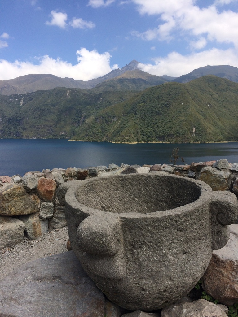
On this special short tour you’ll also pass some recently renovated indigenous-cultural spots. Like a solar and a lunar calendar, as well as a place for offerings & a ritual bath. For most indigenous people the mountains, lakes and waterfalls are Holy places where they periodically gather to ask their Gods for protection.
Visit Cuicocha on the weekends
On the weekends there are small boats (up to 20 people) that for a few dollars take you on a short tour of the lake (30-40 minutes).
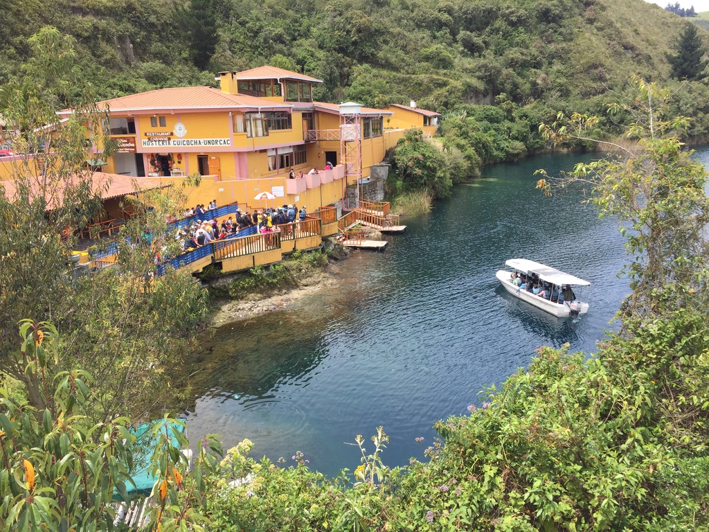
The boat tour takes you around the two islands or sometimes through the small channel between them. This channel is called the Canal de los Ensueños, which translates as Dream Channel. Or maybe better, the Dreamy Channel.
Many years ago it was possible to visit the bigger island. However, soon a fire broke out and devastated a big chunk of it. Luckily nature has taken over again, but you can still see the consequences. Some constructions on the island survived, as well as a little chapel (that you can spot even from the shore).
Although you can’t visit the islands themselves, every boat makes a short stop on the far side of the islands. There’s where your guide will give you some background information about the lake & islands (mostly in Spanish).
Because you find yourself on a spot that’s permanently monitored for volcanic activity, the guide – as proof – will indicate where you can spot little gas bubbles coming up from the bottom of the lake (the deepest point of the lake being 200m/ 656 ft below)
- Important note: The boat ticket includes a drink afterwards, a so-called Canelazo. A typical drink from the Ecuadorian highlands – cinnamon tea with a shot of local brewed alcohol. A famous beverage we also offer every guest that comes for dinner to our restaurant Árbol de Montalvo in the center of Otavalo.
Tips & recommendations for your visit to the Cuicocha lake
- Start early! I would say between 8-9 am. The best moment to hike in the Ecuadorian Andes is in the morning. Generally, in the afternoon clouds come rolling in.
- Follow the paths. The paths are well indicated, so you won’t lose yourself. In certain parts, where it gets a little steeper, the park authorities constructed stairs.
- Bring your own food & drink. During weekdays there’s not much for sale at the lake. On the weekends you can buy something at the cafeteria or even have a bite in the local restaurant. It’s better & cheaper though to get your provisions elsewhere.
- On the far side of the lake there are two palapas (“open-sided dwellings with a thatched roof”). Because you’re halfway, that may be a good spot to have a break. But of course, depending on the weather you can have a rest & a bite anywhere.
- Quite a few people visit Cuicocha with a guide. However, it’s easy to make the round on your own. Still, if you want one, guides are available in Otavalo & Cotacachi.
- Be prepared for every type of weather: cold, warm, sunny, rainy. Sometimes it even can hail or snow.
- Protect yourself from the sun (at least Protector 50).
- If open, visit the museum at the Visitors center of the Cuicocha lake. It’s small, but it gives you a good idea of the place you are visiting. Location, geography, flora & fauna, …
Cuicocha: How to get to there
The best way to get to the Cuicocha lake is by taxi or pick-up. You can find them all over Otavalo & Cotacachi.
- I would recommend you to negotiate a price beforehand & pay at the end of the tour.
- And secondly, be sure he – or sometimes she – knows how to drive. (Hard to know beforehand, but I’d say hire a somewhat older driver – not the young guys – and if you don’t like the way he/she drives soon enough, look for another one).
- Entrance to the Cuicocha lake is free. However you have to inscribe your name, nationality & passport number at the gate (Note: Bring your passport, or better a copy. Something I would recommend you to do everywhere in Ecuador.)
- There are Park rangers at the entrance, but seldom in other parts.
Where to stay in Otavalo/Cotacachi:
As you would guess, there are many options to stay overnight during your visit to Otavalo or Cotacachi. Be it a Hotel, or an Airbnb.
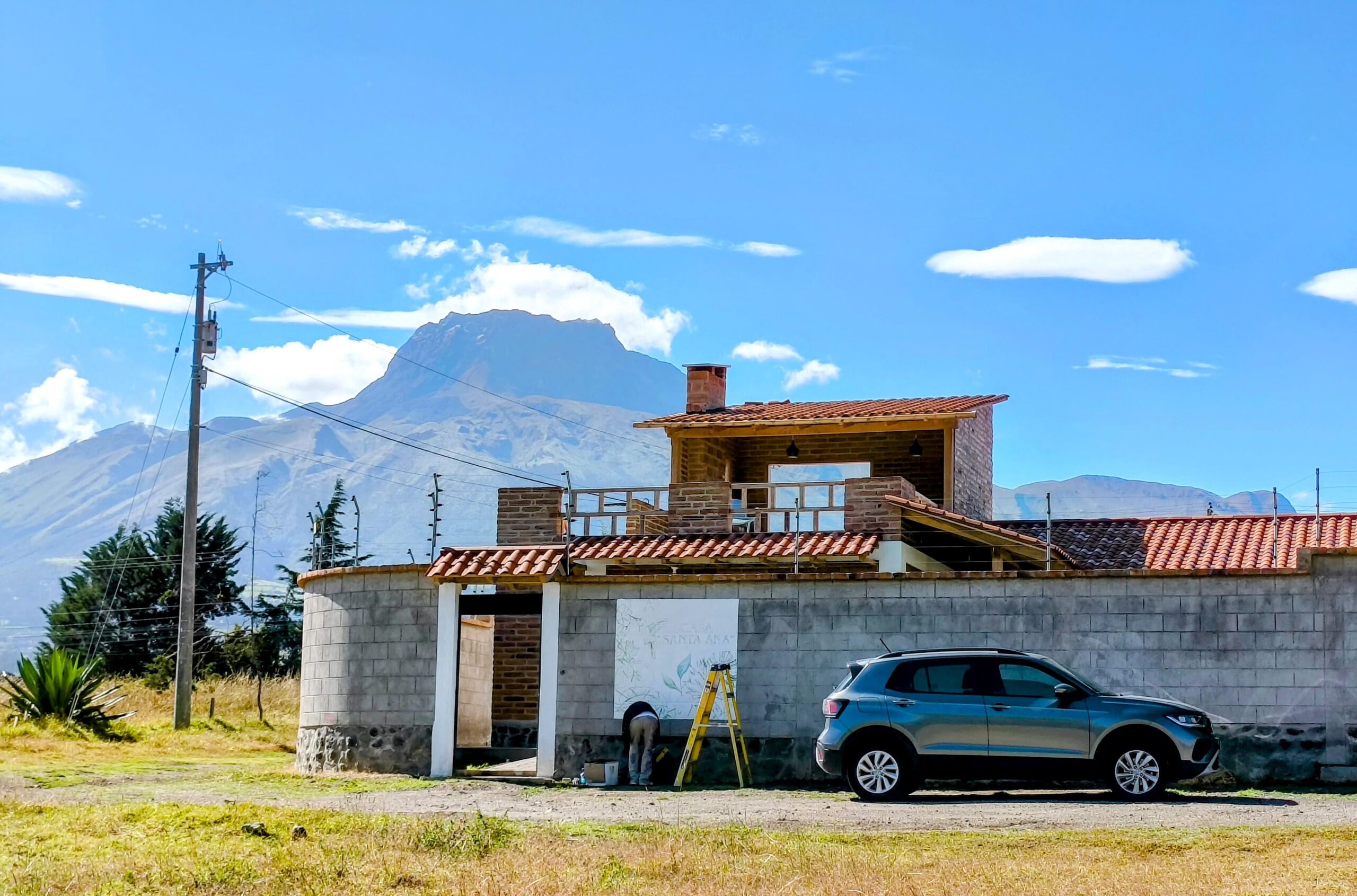
A hotel you can find on your preferred Hotel website. However, when you decide to stay a little longer – 3 nights or more, or even several months – I’d like to introduce our Airbnb in Cotacachi.
A complete rental home we – that’s me & my wife Wendy – recently finished building for people who want to visit & explore the many Things to do in & around Cotacachi.
- We owned & ran a hotel in neighboring Otavalo for over 22 years. After selling the place we decided to continue on with a smaller accommodation in neighboring Cotacachi.
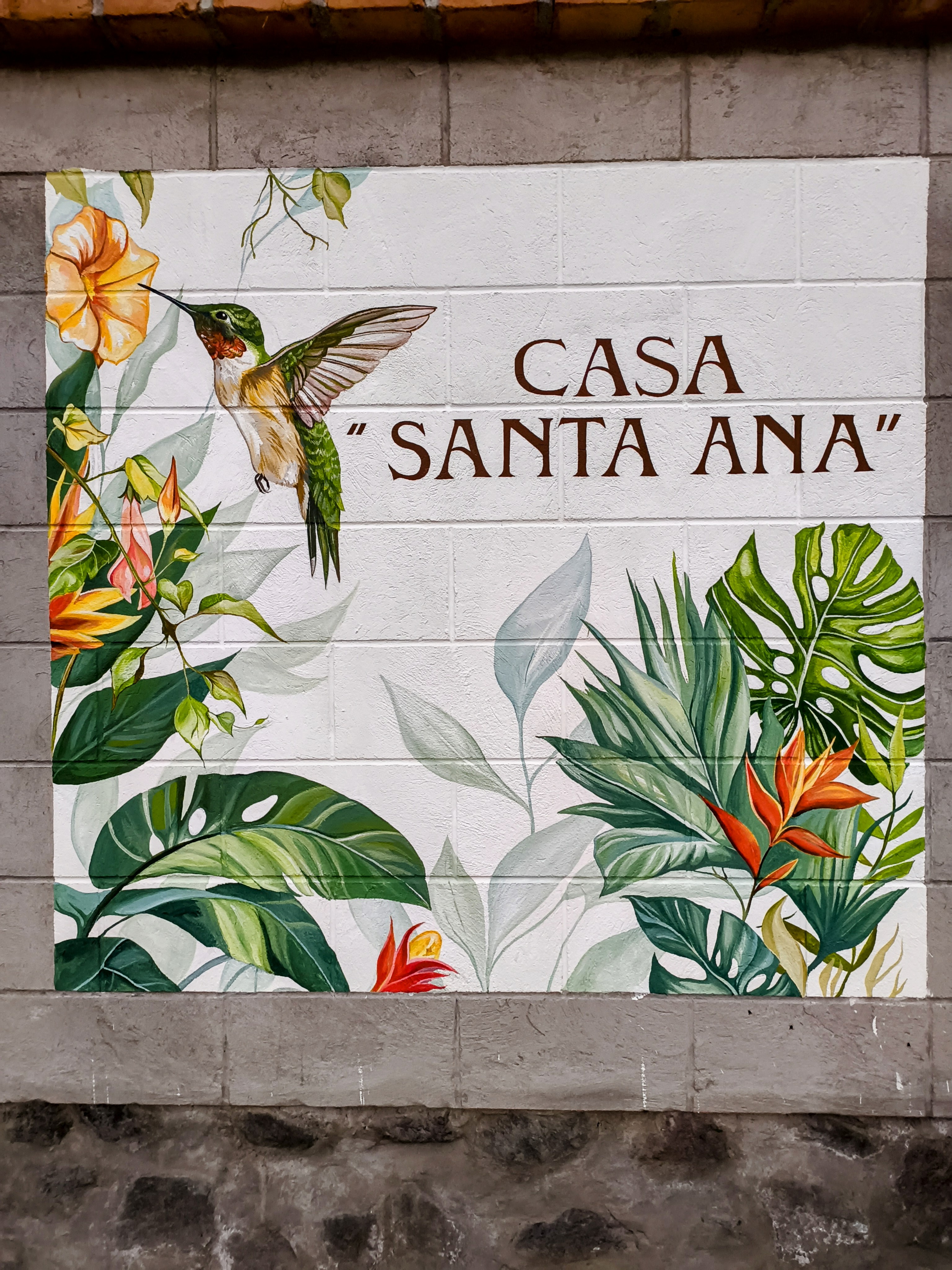
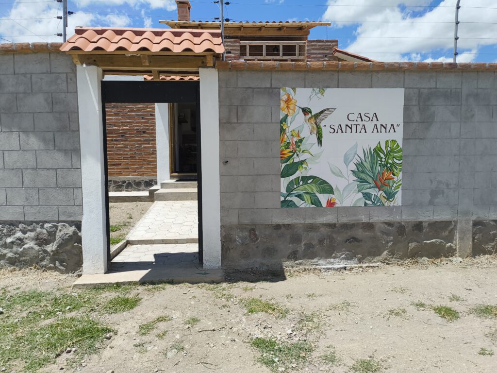
Casa Santa Ana
An Airbnb we named Casa Santa Ana. After the official name of our “Magical City”: Santa Ana de Cotacachi. As well as my wife’s mother Anna.
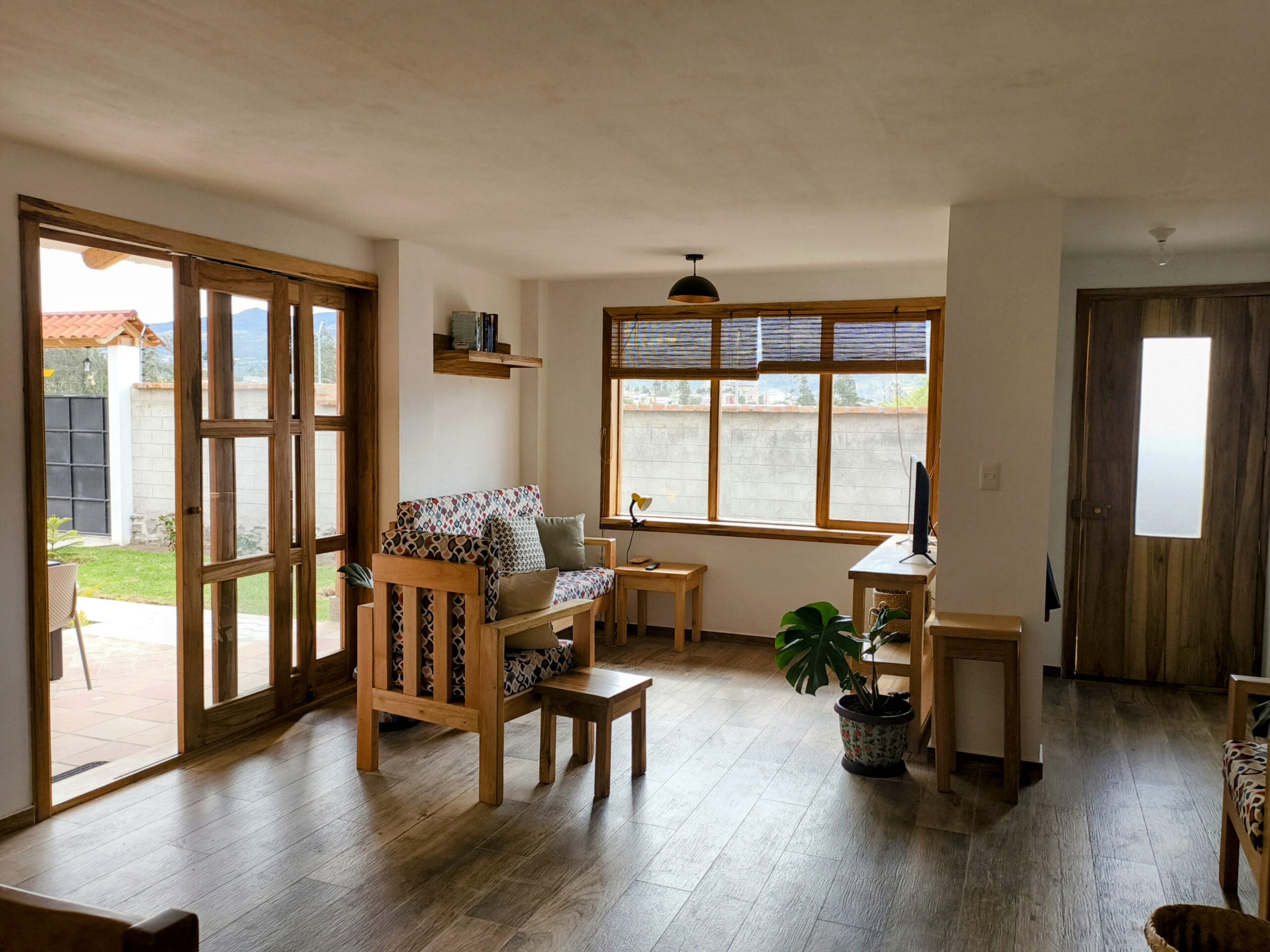
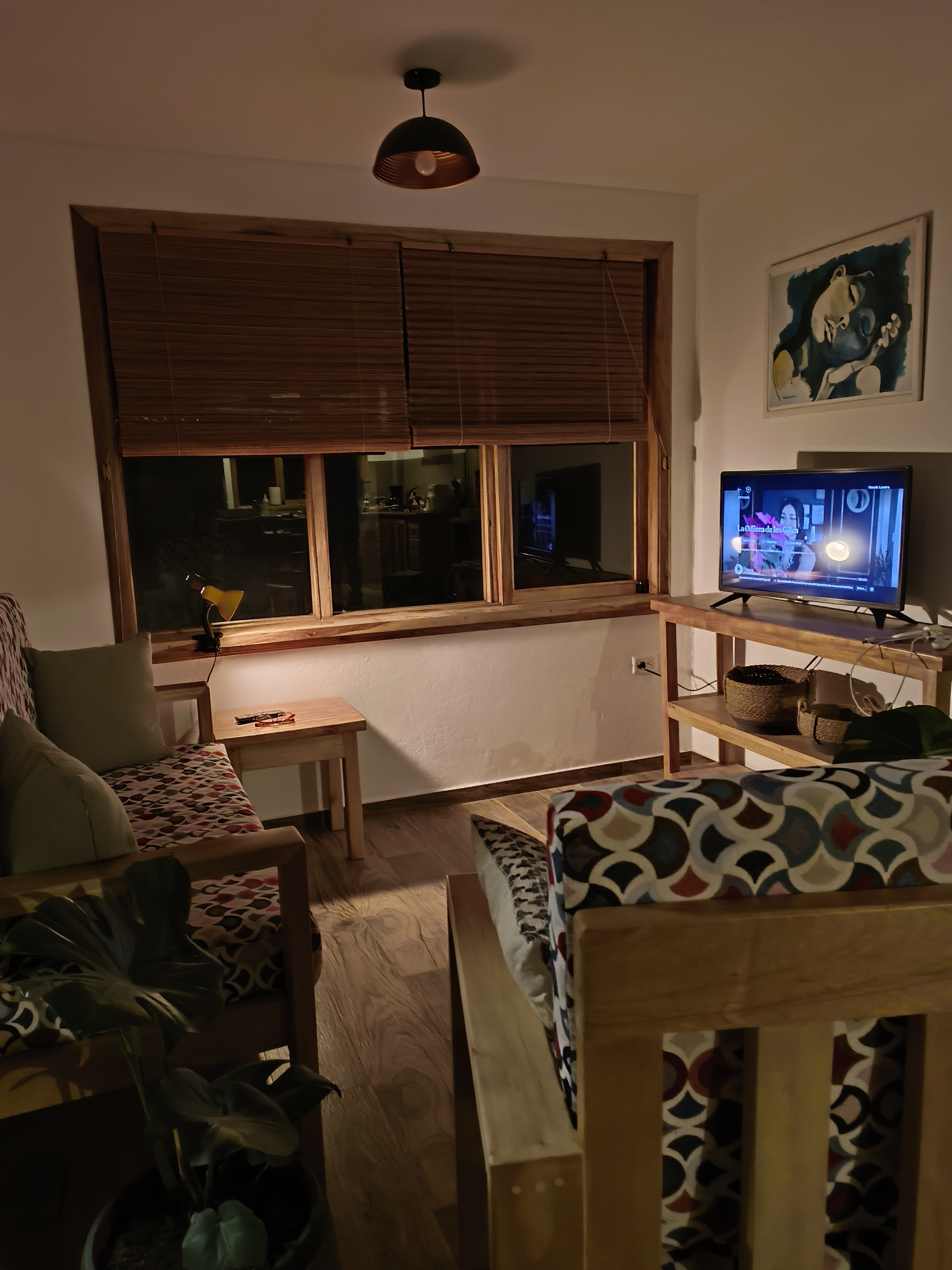
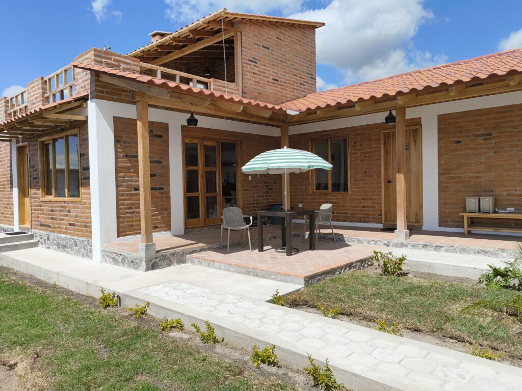
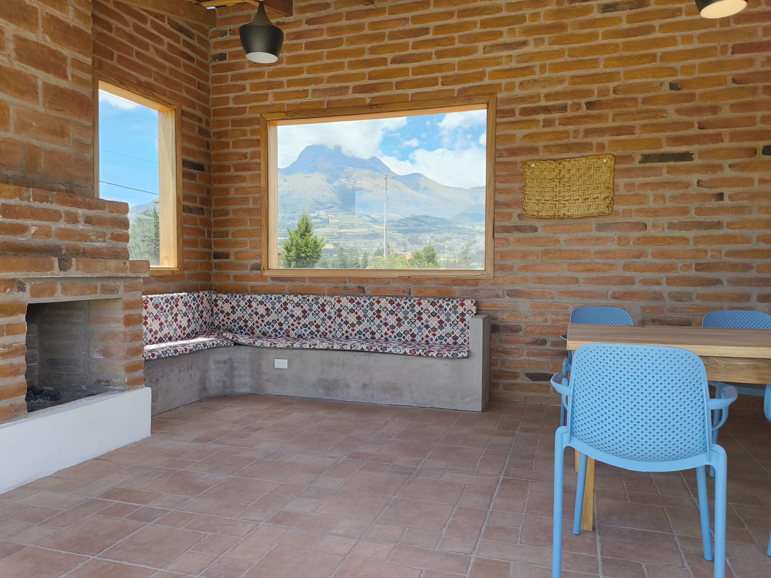
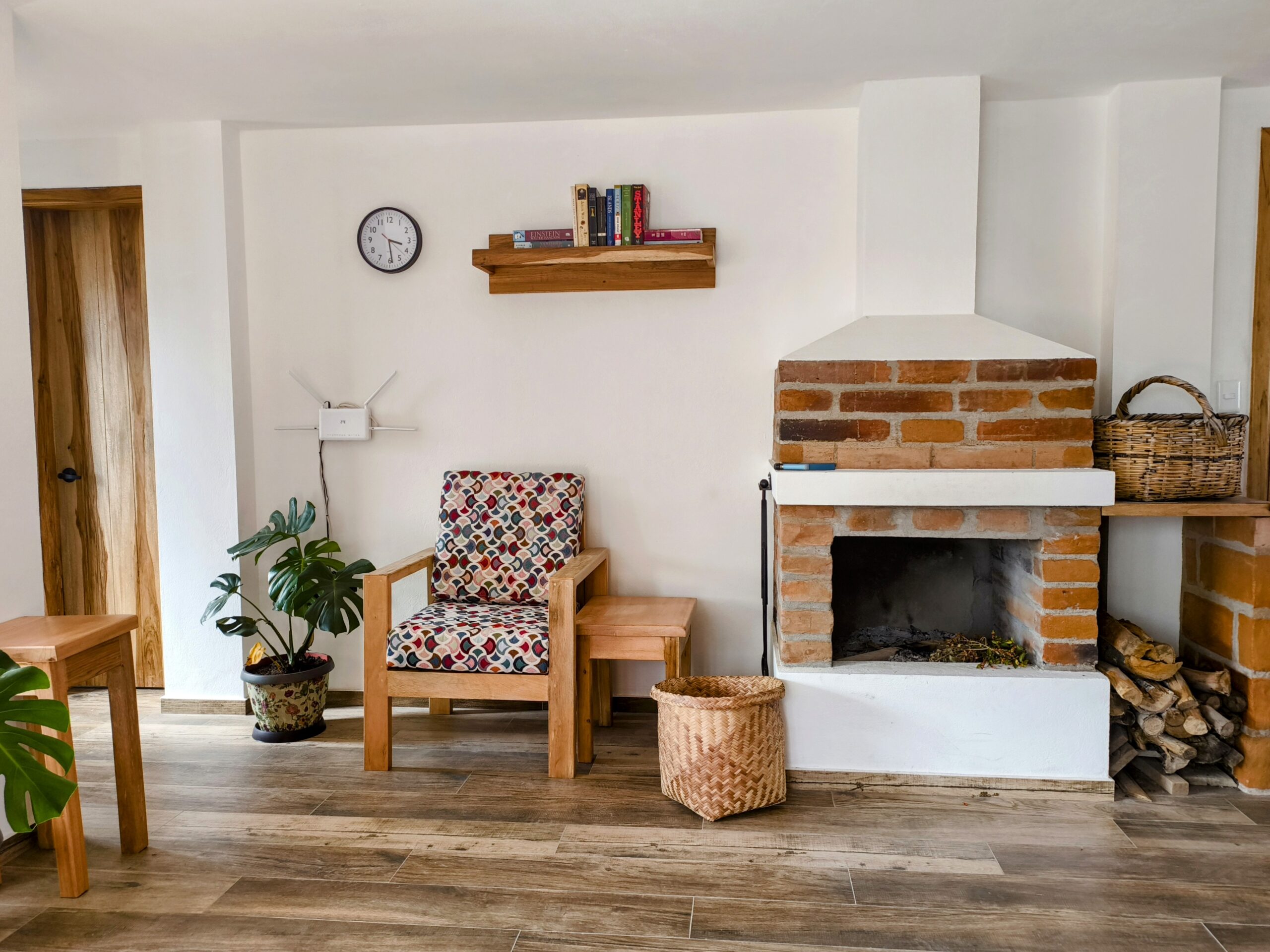
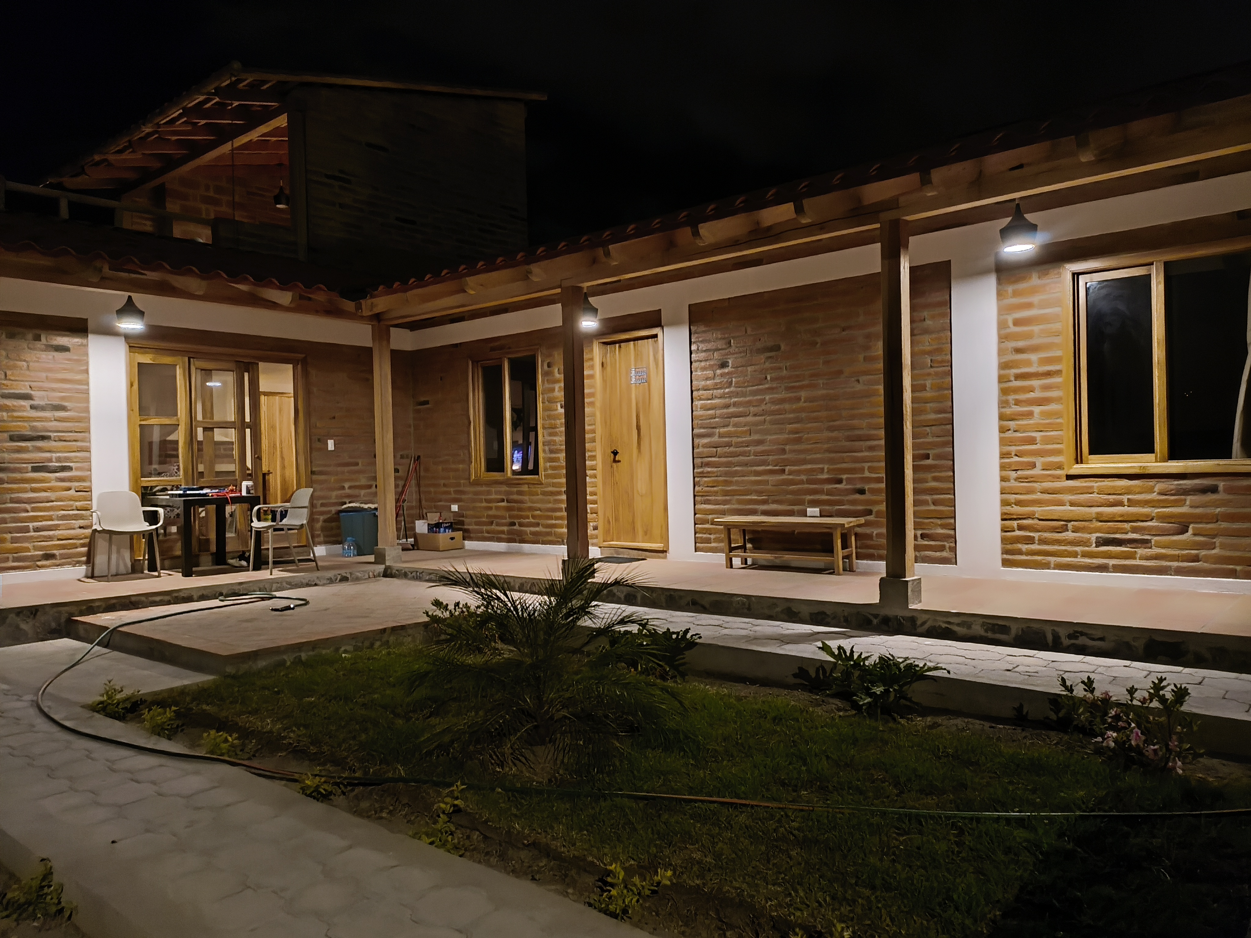
Besides a spacious living room with chimney & full equipped kitchen, our Airbnb has two separate bedrooms. Each with its own bathroom. Ideal for 1, 2 to 4 people. Or also a family with 2 or 3 smaller children.
- Minimum stay: 3 nights. Maximum stay: several months.
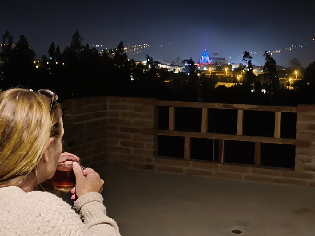
From the partially covered rooftop terrace – also with a chimney – you have magnificent views of the old city center & surrounding area. Like the mountain of the same name in the background.
- Mt. Cotacachi is the 11th highest volcano of Ecuador (4,944m/16,220ft).
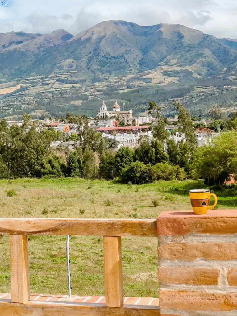
Mt. Cotacachi is still covered in the clouds.
To learn more about this overnight option in Cotacachi, click on:
In conclusion, when you plan to stay a few days/nights in Otavalo or Cotacachi, a visit to the unique Cuicocha lake is a MUST.
- For extra general info about Ecuador, please join my Visit Ecuador Facebook Group.
*****
For other attractions nearby: Things to do in & around Otavalo/Cotacachi
For an overview of all travel posts of my blog, go to: the Home Page.