
Ecuador – What’s in a name?
When you visit a foreign country, and certainly an exotic destination like Ecuador, it’s interesting to have some basic information about the country. Like for example, how did it get its name?
An imaginary line
Over the years more and more travellers have chosen the little Andean country of Ecuador for their next visit. A beautiful country, with – when you think of it – a curious name. Why name your country after an imaginary line?
To be fair, Ecuador isn’t the only country that is named after a geographical characteristic. My country of birth is a good example. The Netherlands received its name because a big part of it is located below sea level.
Another and even better example is Australia, named after the long sought for South Land or Terra Australis. The name Australia, like that of the North & South Pole – the Arctic and Antarctica – all originated in Greek science and language.
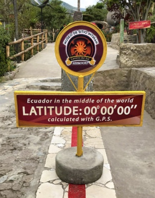
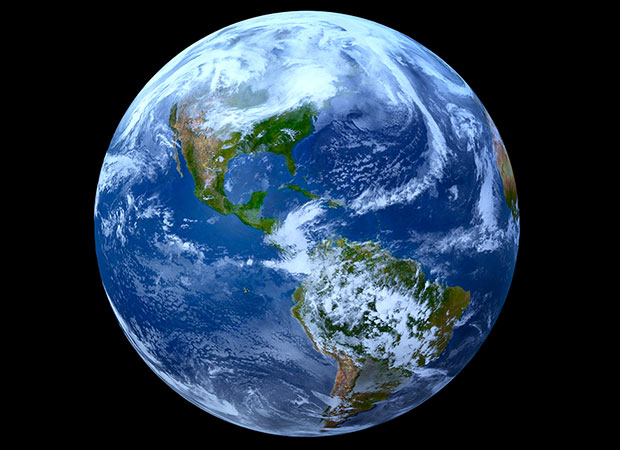
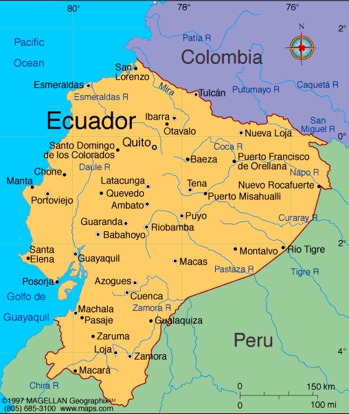
Ecuador obviously is named after the fact that it’s located on the Equator, the invisible line that divides our planet in a Northern and a Southern hemisphere.
- Note: Although the biggest part of Ecuador is located in the Southern hemisphere, I still live with my small family in the Northern part. The hemisphere in which I was born (see About me). In other words, Our business & house are still located north of the Equator.
Why has this relatively small country in South America received this peculiar name, while there are a dozen more countries lying on the Equator?
- Note: Besides Ecuador, there’s Colombia, Brazil, Sao Tome & Principe, Gabon, Republic of the Congo, Democratic Republic of the Congo, Uganda, Kenya, Somalia, Maldives, Indonesia and Kiribati. And curiously, the little African country of Equatorial Guinea isn’t.
Let me take you back in time
Their is an historical explanation for the name of the country.
Way back in time our ancestors worldwide lived in little settlements or communities. There weren’t nations yet as we know them today, nor borders. As a matter of fact, the formation of “nations” and “nationalities” in many ways is a modern day invention.
So, for most of our past we didn’t belong to a named country or a nation. For the people that lived in the territory of today’s Ecuador, all that changed with the invasion of the Inca’s from Peru.
The Inca’s didn’t give the current “Ecuador” its name. However, after their conquest they somehow glued the territory together for the first time in history. It represented the Northwestern region of their Empire, the Tahuantinsuyo (Quichua for “the Four regions”).
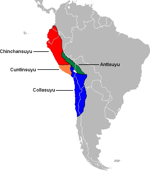
- Note: As you can see on the map above, today’s Ecuador was only a part of the northern region of the Tahuantinsuyo. However, what’s important here, is the fact that with the invasion it became part of the Inca Empire and the Inca culture. This is the main reason why the majority of the indigenous people speak Quichua nowadays, the Inca’s language.
Soon after the Inca’s, the Spanish conquest and colonization of South America followed. The Spaniards decided that this region became part of Peru. They named it the Real Audiencia de Quito, after it’s capital – the most northern province of Peru.
After almost three centuries, the Spanish rule over most Latin-American countries ended. In 1822 this region reached independence and the Audiencia de Quito was absorbed by the northern republic of Gran Colombia.
Independence… looking for a name
In 1830 “Quito” separated itself from Gran Colombia and became an independent nation. At that time it had to choose a proper name to distinguish itself from its larger neighbours, as well as their permanent claims to parts of its territory.
- Note: Through history the country has known several border-conflicts with Colombia, and mostly with Peru. The most recent one was the Cenepa War with Peru in 1995.
Then somebody must have remembered that almost a century earlier a French scientific mission (1735-1745) had chosen the country to realize one of biggest experiments the world had ever seen. They came all the way from Europe to measure a degree of latitude from the Equator.
Further reading
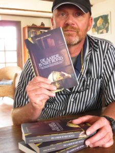
An amazing story. I will tell you all about it in a next post. Well, not really “all”… I will give you a summary of that adventurous expedition. To know all about it, I would like to recommend the book I wrote about the whole adventurous: De Aarde is niet rond – The Earth isn’t round.
- Note: Unfortunately, only published in the Dutch language so far. Available Online, as well as by contacting me directly.
However, there are some good reads out there in English (one translated in French & Spanish). Highly recommended before your visit to Ecuador.
- First of all, the beautiful story written down by Larrie D. Ferreiro, Measure of the Earth – The enlightment expedition that reshaped the world, 2011
- Secondly, the book written by Ken Alder, The measure of all things – The seven year odyssey and hidden error that transformed the world, 2002. But also translated in several languages, like French & Spanish.
In conclusion
In conclusion, although many inhabitants of the future Ecuador were very suspicious of the French gentlemen – traversing their country from north to south, east to west – there was obvious something special about their place on Earth. The Equator – Ecuador!
Coming up:
In the next post of this “French geodesic mission”-section I will tell you about their scientific goal: To measure the Earth (1735-1745).
After that, in a third post I’ll tell you all about the Pyramids of Ecuador. And finally in a fourth & final post introduce you to Other Monuments that remember the French scientists.
*****
- For all the latest news on Ecuador, join my Visit Ecuador Facebook Group.
.
For an overview of all travel posts of my blog, go to: the Home Page.